


Meet the teams

Team Taxi
We thought it would be nice to let our Digital interns Frank and Wei Hong take the easy way out. They booked a standard cab via the Grab app. Expectations were high they would reach first but we did wonder if traffic and ERP tolls would drive up the time and cost.

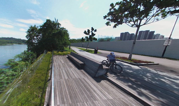
Team Cycle
The volunteers on two basic foldable bikes were journalist Danson and Web developer Chih Hui. We wondered how long it would take them to pedal to CBD, if any paths would be bumpy, and how sweaty they might get given the temperature at the start was around 27 deg C.

Team Public Transport
Journalist Rebecca and designer Rodolfo took a feeder bus and the MRT. We wondered if the crowded trains during morning peak hour would make for an uncomfortable ride or even increase the overall travel time.
Ready, steady, go!
Play and pause the map to see who reached the destination first.

The winner!
Well, the taxi won the race for obvious reasons, but Team Cycle didn’t do too badly either.
Cycling may not be the fastest option for this route, but what surprised us was that the team was just 12 minutes behind the team that took public transport.
In fact, smoother or wider paths in certain places along the cycling route could help to speed up the overall time, perhaps even by up to 10 minutes.
The stretch between the Ulu Pandan and Alexandra park connectors was difficult to weave through because of the morning peak hour crowd. ST journalist Danson Cheong rang his bicycle bell 35 times while on the footpaths as opposed to just 6 times while on the park connectors.
A Land Transport Authority (LTA) spokesman has confirmed there will be a dedicated cycling path built between the two park connectors as proposed by MP Muhammad Faishal Ibrahim when he was Parliamentary Secretary for Transport in 2015.
As for the CBD, the LTA has built two cycling paths, one along Marina Boulevard and one next to Gardens by the Bay. A bike-sharing pilot programme will be launched this year aimed at encouraging more to cycle to commute between homes, nearby amenities and MRT stations.
CYCLE STATS
Why did we choose this route?
Clementi is connected to the city by a busy MRT line, an expressway with ERP tolls, and two path connectors. It was ideal for the real-time test using three modes of transport during peak hour on a weekday.
Hmm, where else could we cycle?
Here are two other routes where cycling could be a faster and cheaper option.
Punggol to Tampines
With no direct MRT lines connecting these two areas, the possible options for commuters is either a combination of bus and LRT, and by car.
But with the LTA and NParks building cycling paths and park connectors in the area there is now a third option: Cycling.
On a cost versus time basis, travelling by bicycle is estimated to take around 35 minutes at 15kmh cycling speed versus public transport which takes almost an hour and costs $3.06 return. A car is faster at 14 minutes but costs around three times as much as public transport at $9.80 return.
Bukit Batok to Jurong East
Last year, the URA announced long-term plans to turn the Jurong Lake District into Singapore’s second CBD.
Although Bukit Batok has recently been connected to the CBD with the opening of the Downtown Line in 2016, it is close enough to Jurong East to make for a suitable route for commute.

The LTA has built two cycling path stretches in Bukit Batok and there are two park connectors, east and west, which serve the area.
The route from Block 170 Bukit Batok West Avenue 8 to Jurong East (as shown in map) is along footpaths and takes a similar route as a car. But it is slightly faster than the total time spent on a feeder bus, door to door.